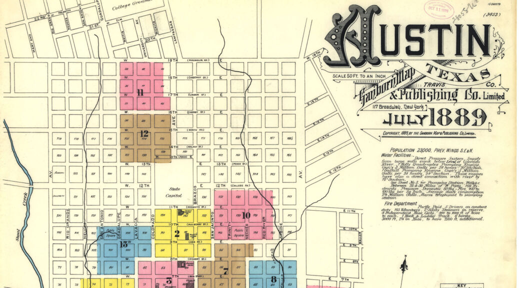
In the digital age, historical maps hold a wealth of information, but unlocking their full potential for geospatial analysis and historic research often requires labor-intensive georeferencing. An innovative project the University of Texas Libraries is evolving this process through the power of machine learning.
Editors’ Choice: Historic Maps, New Coordinates