The folks at the New York Public Library have a workflow and python script for translating historical maps into Minecraft. It’s a three-step (quite big steps) process. First, they generate a DEM (digital elevation model) from the historical map, using QGIS. This is saved as ‘elevation.tiff’. Then, using Inkscape, they trace over the features from the historical map that they want to translate into Minecraft. Different colours equal different kinds of blocks. This is saved as ‘features.tiff’. Then, using a custom python script, the two layers are combined to create a minecraft map, which can either be in ‘creative’ mode or ‘survival’ mode.
There are a number of unspoken steps in that workflow, including a number of dependencies for the python script that have to be installed first. Similarly, QGIS and its plugins also have a steep (sometimes hidden) learning curve. As does Inkscape. And Imagemagick. This isn’t a criticism; it’s just the way this kind of thing works. The problem, from my perspective, is that if I want to use this in the classroom, I have to guide 40 students with widely varying degrees of digital fluency.* I’ve found in the past that many of my students “didn’t study history to have to work with computers” and that the payoff sometimes (to them) doesn’t seem to have (immediate) value. The pros and cons of that kind of work shall be the post for another day.
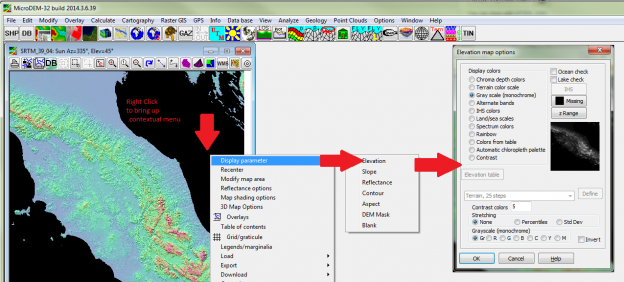
Right now, my immediate problem is, how can I smooth the gradient of the learning curve? I will do this by providing 3 separate paths for creating the digital elevation model.

