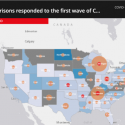
In March 2020, when the COVID-19 virus started to spread throughout New York City, former Digital Fellow Javier Otero Peña and I got together to think about the ways mapping could be used to identify some of the challenges produced by the pandemic. At the time we were co-coordinating the GIS /Mapping Working Group on the CUNY Academic Commons and over the years we had seen the many ways that GIS users throughout CUNY were constantly trying to use mapping to address some of the most current and urgent social issues.
Editors’ Choice: Mapping the Effects of COVID-19

