
The following is a guest post by Kalev Hannes Leetaru, a data scientist and Senior Fellow at George Washington University Center for Cyber & Homeland Security. In a previous post, he introduced us to the GDELT Project, a platform that monitors the news media, and presented how mass translation of the world’s information offers libraries enormous possibilities for broadening access. In this post, he writes about re-imagining information geographically.
Why might geography matter to the future of libraries?
Information occurs against a rich backdrop of geography: every document is created in a location, intended for an audience in the same or other locations, and may discuss yet other locations. The importance of geography in how humans understand and organize the world (PDF) is underscored by its prevalence in the news media: a location is mentioned every 200-300 words in the typical newspaper article of the last 60 years. Social media embraced location a decade ago through transparent geotagging, with Twitter proclaiming in 2009 that the rise of spatial search would fundamentally alter how we discovered information online. Yet the news media has steadfastly resisted this cartographic revolution, continuing to organize itself primarily through coarse editorially-assigned topical sections and eschewing the live maps that have redefined our ability to understand global reaction to major events. Using journalism as a case study, what does the future of mass-scale mapping of information look like and what might we learn of the future potential for libraries?
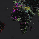
What would it look like to literally map the world’s information as it happens? What if we could reach across the world’s news media each day in real time and put a dot on a map for every mention in every article, in every language of any location on earth, along with the people, organizations, topics, and emotions associated with each place? For the past two years this has been the focus of the GDELT Project and through a new collaboration with online mapping platform CartoDB, we are making it possible to create rich interactive real-time maps of the world’s journalistic output across 65 languages.
Leveraging more than a decade of work on mapping the geography of text, GDELT monitors local news media from throughout the globe, live translates it, and performs “full-text geocoding” in which it identifies, disambiguates, and converts textual descriptions of location into mappable geographic coordinates. The result is a real-time multilingual geographic index over the world’s news that reflects the actual locations being talked about in the news, not just the bylines of where articles were filed. Using this platform, this geographic index is transformed into interactive animated maps that support spatial interaction with the news.
Source: Mapping Libraries: Creating Real-time Maps of Global Information